
Yesterday, Barb and I drove out to several locations within the Salt River watershed. It appeared that Francis Creek was moving quickly, but staying within its banks from Firemen’s Park all the way through town to Van Ness. When we crossed 211 to check Ambrosini Lane, we were immediately stopped by high water on the roadway and in the adjacent fields from Williams Creek.
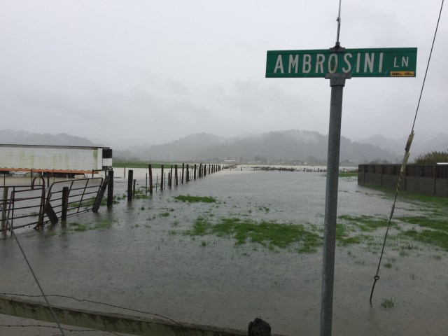
1/17/16 at Ambrosini Lane
We could not drive down California or Rasmussen roadways due to high-water levels. I would imagine that the folks living along Port Kenyon Road are heavily impacted by high water.
By taking Fulmor Road to Goble Road to Dillon Road, we were able to access the Dillon Road bridge and view the Salt River.
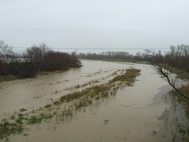
1/17/16 Salt River at Dillon Road Bridge looking east toward Ferndale.
The Salt River was inundated with water from bank to bank and moving toward the Eel River. Yesterday’s rainfall levels were predicted between two and three inches.
This morning, January 18th, Barb and I took a trip out to Fernbridge. The Eel River was above flood stage at approximately 21 feet. There appeared to be flooding on farm land directly adjacent to the river.

As I write this post, another storm has begun to deliver more rainfall to the Eel River Valley. Rainfall is predicted to be no more than a tenth of an inch today, but more rain is on the way.


